Home Page
Kingdom
Index Plant
Index Magnoliopsida
Index Scrophulariaceae
Index
Pedicularis lanata Cham. & Schlecht
Pedicularis kanei Dur.
29 photos.
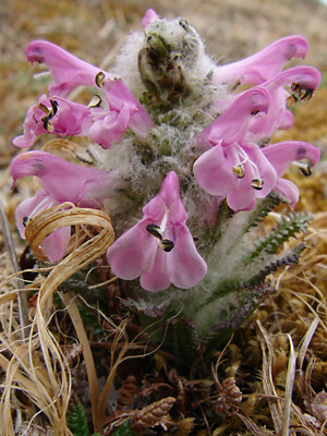
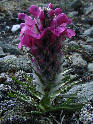
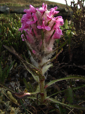
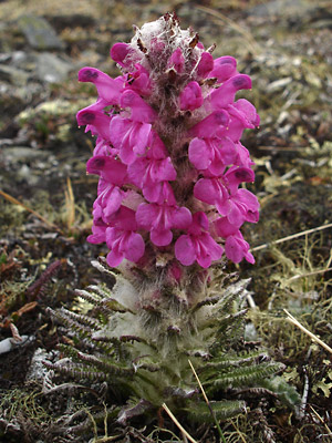
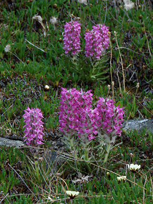
A common species found on mountains and passes throughout the area known
as the
"woolly lousewort" or "bumble-bee flower".
Pedicularis lanata Cham. and Schlect.
has been moved to the family Orobanchaceae according the
ITIS
Standard Report for Taxonomic Serial No. 33364.
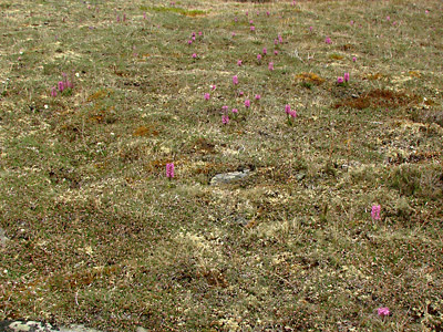
1. Early June. A large group of plants in an alpine meadow.
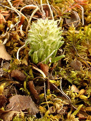
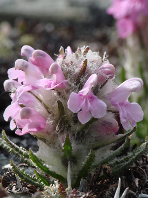
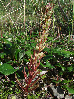
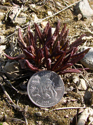 2. May 18, 2009. A plant just sprouting. Note the reddish brown leaves. |
 3. May 18, 2009. Another plant with the woolly stem emerging from the basal leaves. |
 4. Mid-May. A plant at the same stage as the plant in photo 3 but with light green leaves and bracts. |
 5. Mid-May. Another young plant with leaves having a green middle with reddish brown pinnate segments. |
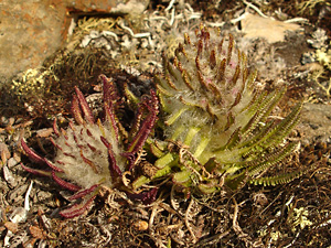 6. Mid-May. A pair of different young plants. The red flowers are just visible through the wool on the right plant. |
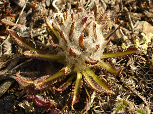
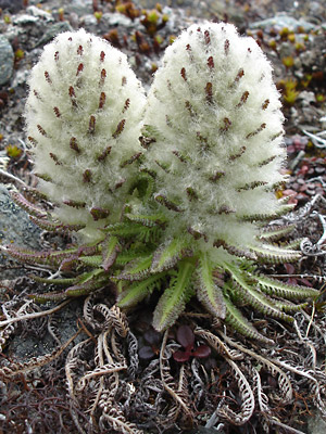 7. Late May. A pair of very woolly young plants with green leaves. |
 8. Late May. Two very small plants just beginning to bloom. |
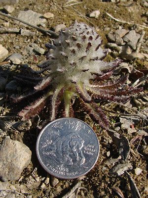
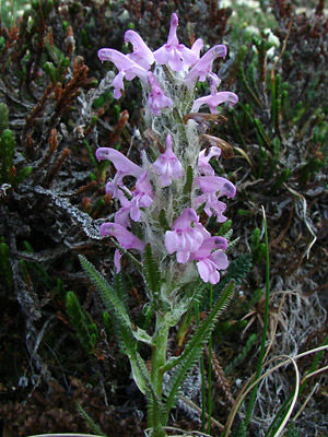
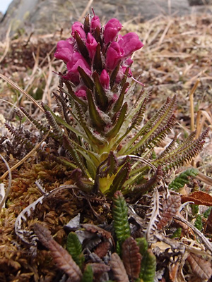
 9. Mid-May. A plant with a few red blossoms at the top. |
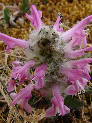
 10. Mid-May. Top view of a plant similar to the plant in photo 9. |
 11. Late May. A plant with an elongated stem. Note that the basal leaves have separated as the stalk has elongated. Again the top os the stalk blooms first. |
 12. Late May. Another plant similar to the plant in photo 11with even more separation of the basal leaves. |
 13. Late May. A plant in bloom over half of its visible length. the degree of separation of the basal leaves is hidden by wool. |
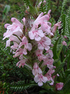
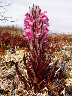
 14. Mid-June. Several plants in full bloom. |
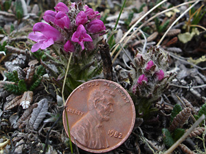
 15. Late May. A young plant with pink blossoms. |
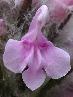 16. Late May. A single blossom from the plant in photo 15. |
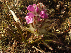
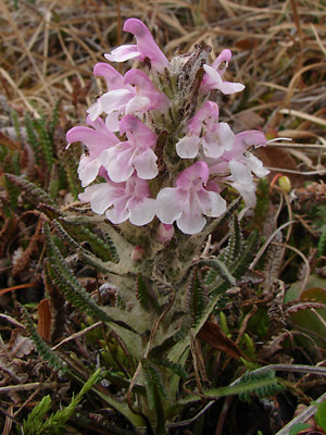
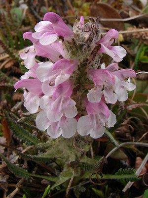
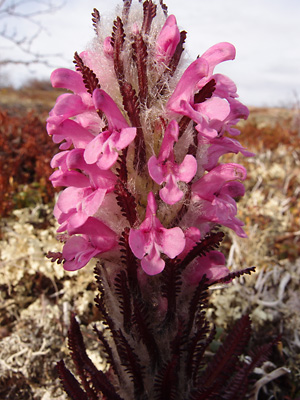
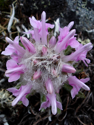 17. Late May. Top view of a pink-blossomed plant in bloom. |
 18. Early June. A pink-blossomed plant. The blossoms are drying out. |
 19. Mid-June. Another pink-blossomed plant with drying blossoms. Note how the stem has elongated . |
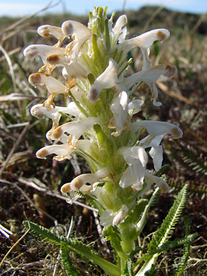 20. Mid June. A plant with drying white blossoms. The plant was rooted in moss. |
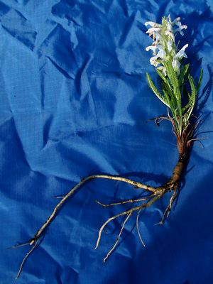 21. Mid-June. The entire plant in photo 20. Note the long taproot. |
|
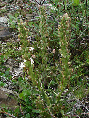 23. Early June. Another cluster of plants with withered blossoms. |
 24. Mid-June. Close-up view of a plant similar to the plant in photo 23 with a good view of the developing capsules. |
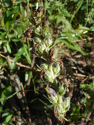
 25. Late June. Another plant with developing capsules. Note the red color of the leaves, bracts and stem. |
|
|
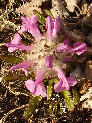
 28. June 1, 2009. A plant with unusual blossoms having a pink galea and white lower lip. |
 29. June 1, 2009. Top view of the plant in photo 28 |
 30. May 24, 2012. Red-leaved plant in bloom behind a sprouting red-leaved plant |
 31. May 24, 2012. Close-up of the inflorescence of the plant in photo 30. |
 32. May 30, 2012. Another plant with green leaves. |
Photos 1, 14, 18, 19, 23, 25, 28 and 29 Photos 2 and 3 taken on Eagle Summit Photo 4 taken on Photos 5, 6, 9 and 10 taken southwest of |
Photos 7, 8, 11, 13 and 15-17 Photo 12 taken along the Pinnell Mountain Photos 20 and 21 taken on a ridge southeast Photo 22 taken 1.5 miles northeast |
| Photo 24, the only lowland photo Photos 26 and 27 taken on the east side Photos 30 and 31 taken on Portage Summit Photo 32 taken in the saddle between
|
||