Home Page
Kingdom
Index Plant
Index Magnoliopsida
Index Rosaceae
Index
12 photos.
A small species with a large orange edible berry known as the "cloudberry",
"salmonberry", baked-apple berry",
"dwarf mulberry", or "yellowberry". Both male
and female structures are found on the blossoms, however
on some plants the stamens are dwarfed while on other plants the pistils
are dwarfed.
ITIS Taxonomic Serial No. 24850
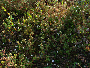
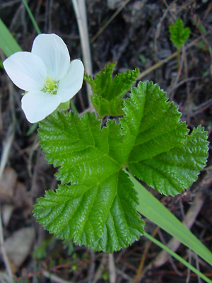
1. Mid-June. Probably a single male plant with many leaves and
blossoms.
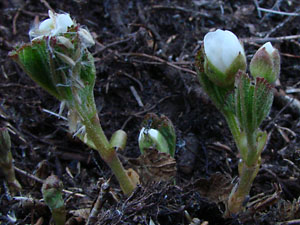
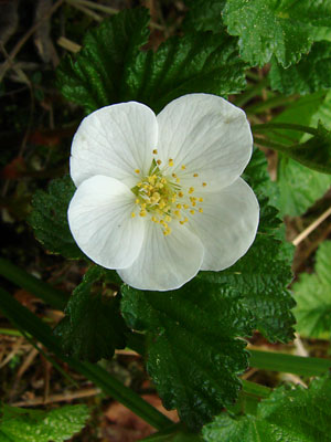 2. Mid-June Close-up of a single male blossom. |
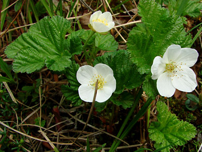
 3. Mid-June. A female plant with a single blossom. |
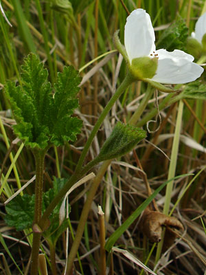 4. Early June. Profile view of a tall male plant growing in a shaded grassy area Leaves haven't spread out fully. |
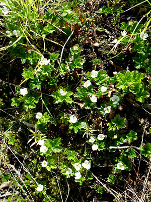 5. Early June. Several plants growing on relatively barren ground. |
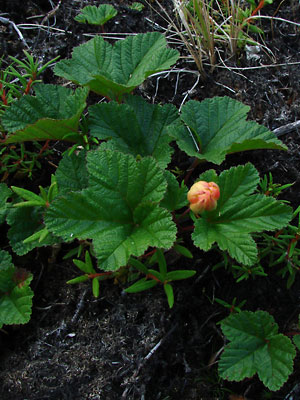 6. Plant with developing berry enclosed by sepals. |
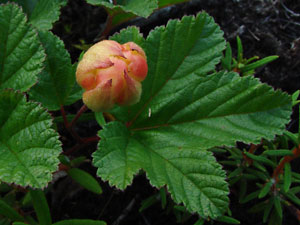 7. Closer view of the berry in photo 7. |
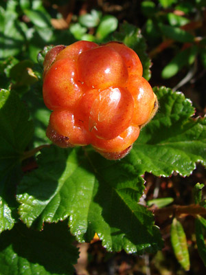 8. Early July. Close-up of a single berry. |
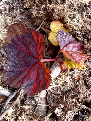 9. Late August. Leaves in fall color. |
|
|
|
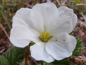 12. June 9, 2012. Close-up of a female blossom. |
Photos 1 and 2 near upper Half Dollar Photo 3 taken along a trail through a meadow Photos 4, 5, 10 and 11taken in a burn area Photos 6 and 7 taken on the swamp |
Photo 8 taken adjacent to a thaw Photo 9 taken on a mountainside above Photo 12 taken in the saddle between
|
||