
Home
Page Kingdom
Index Plant
Index Magnoliopsida
Index Ericaceae
Index
Arctostaphylos uva-ursi (L.) Spreng.
13 photos.
Known as the "common bearberry", "mealberry", "kinnikinnick",
"kinnikinnik" (for palindrome lovers),
"kinnikinnic" and several other names. It is a trailing
shrub of well drained areas with an urn-shaped
blossom and a hard, mealy, red-orange berry.
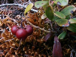 1. Late May. Darkened berries which have wintered over from the previous year. |
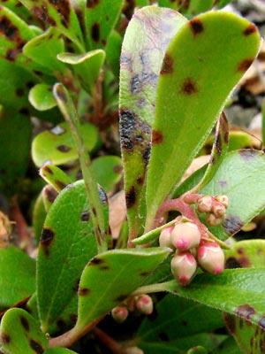 2. Late May. buds and leaves. The dark spots on the leaves are common in the area. |
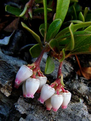 3. Late May. Two blossom clusters. |
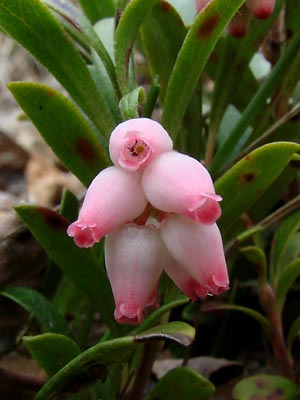 4. Late May. A pink blossom cluster. |
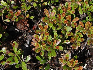 5. Late May. Leaves with a heavy insect? infestation. |
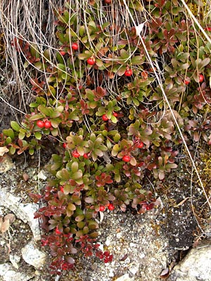
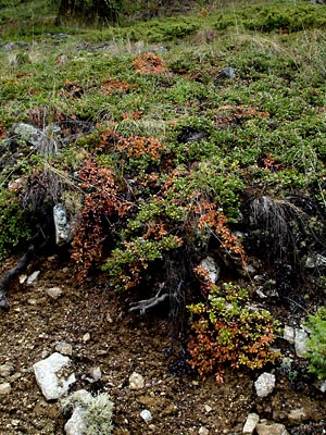 6. Early June. Large area of plants showing the trailing nature of the species. |
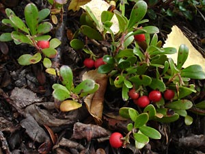 7. Early September. Ripe berries. |
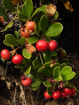 8. Mid-August. Close-up of ripening berries. |
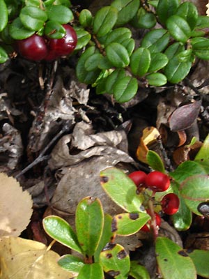 9. Early September. Close-up of ripe berries. These are more flattened than most. Top berries are large lingonberries. |
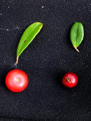 10. Early September. Kinnikinnick berry on the left and lingonberry on the right. On average the more spherical lingonberry is smaller and than the oblate berry of kinnikinnick. |
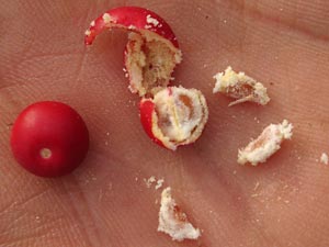 11. Mid-September. Mealy kinnikinnick berry crushed to show nutlets. |
 12. Late September. Trailing plant(s) showing appearance of fall color. |
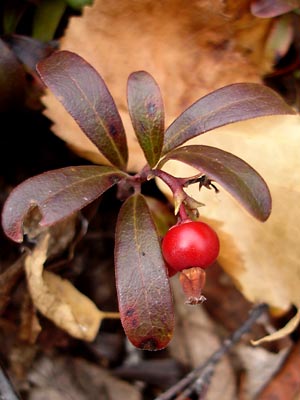 13. Late September. Ripe berry with leaves in fall color. |
1,2,4 and 6 taken along Upper Bottom Photo 3 taken on the Ketchem Rocks. Photo 5 taken on a hilltop Photos 7, 9 and 10 taken on hillside above |
Photos 8, 11, 12 and 13 taken at 9.5 mile Portage Creek Road. 65° 25.19' N 144° 48.20 Elev. 1900 ft. |